Hiking near Gold Beach – Port Orford
Take the family for a nature walk down from Cape Sebastian, challenge Humbug Mountain or set out for overnight backpack trip in the Rogue River Trail or Illinois River Trail through the Siskiyou National Forest and the Kalmiopsis Wilderness.
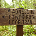
The Rogue River offers several hiking opportunities. The Rogue River Walk is a day trail (no camping) from just east of Gold Beach. The Lower Rogue River Trail 1168 is another day use trail from just east of Lobster Creek to Agness. The Rogue River Hiking Trail is a backpackers dream,starting east of Agness and heading into the wild and scenic portion of the river.
There are a large number of great trails, a short distance south, along the coast. For more information about those hike, see Brookings Hiking.
Blacklock Point – Floras Lake Hike

Blacklock Point is one of the most beautiful spots on the coast, but few are willing to make the hike to see it. The view to the south is of Cape Blanco and the beam from the lighthouse is clearly visible. To the north is a view of the spectacular yellow cliffs (access to the beach below the cliffs is from the north end near Floras Lake and should only be hiked at low tide). The hike to Floras Lake offers access to the beach and the southern edge of Floras Lake.
The Blacklock Point – Floras Lake hike is unlike many of those on the Oregon coast in that it is nearly flat and can be used by mountain bikes and equestrians. The hike starts at a small parking area near a local airport and heads to scenic viewpoints along cliffs, then north to the beaches along Floras Lake.
A loop to both Blacklock Point and Floras Lake is a 10 mile (16 km) round trip. The hike to Blacklock Point is about a 4 mile (6.5 km) round trip. There are at least two unofficial camping spots, one near Blacklock Point, and another on the trail from the point to Floras Lake.
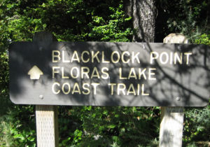
For those desiring a longer hike, head to Blacklock Point, then head north along the cliffs, onto Floras Lake. Then, after reaching Floras Lake, backtrack a bit and find a trail that heads back to the end of the runway of the airport and then back to the parking lot.
Because the trail is mostly flat, it can be muddy and wet after rains well into the dry season.
Download kmz file of this hike for use on Google Earth. Download GPX file of this hike for use in your GPS.
Cape Blanco Lighthouse and State Park
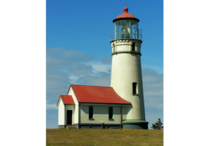
The Cape Blanco Lighthouse is a favorite location for whale watching and offers spectacular views. The Cape Blanco State Park has over 8 miles of hiking trails, beach walks, and 7 miles of horse trails.

The best hiking trails are between the Hughs House and the lighthouse. To access these trails, take the turn to the Hughes House, but turn and head down to a lower parking / picnic area along the river. The trail head is next to the parking lot and offers several alternatives. One option is to hike along the river and out to the beach. At low tide, during the dry season, it is possible to cross the river and hike to Blacklock Point. But be careful about the tides as it maybe impossible to return at high tide. A safer alternative is to hike the beach along towards the lighthouse. There are trails up to the road at several points. Once on the road, start hiking back away from the lighthouse. There are trails to the left of the road that head back through the woods and return to the parking lot.
For the trail head, see the map above.
Humbug Hiking Trail
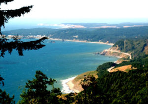
Humbug Mountain hiking trail is 5 to 6 miles (8 to 10 km), depending on route selected, and climbs just over 1,600 ft (500 meters). It is a well maintained trail, quite popular and easy to get to.
The trail starts immediately from the gravel parking lot and climbs steadily. After about a mile, the route splits. The east route is slightly longer and is a more gradual climb. The west route is a little steeper, but offers one spectacular view. It is suggested that the hiker climb using the east route and descends via the west route.

Shortly before the top, the two routes come back together. There are limited views throughout the hike, but the big attraction is the large number of huge old growth trees as well as the challenge of the climb.
At the top, there is a bench and a small view south along the coast. On the west side, there are two benches and an excellent view north towards Port Orford Heads. On a clear day, the Cape Blanco Lighthouse is visible.
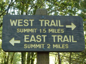
For those wishing to cut the hike in half, yet capture the view, plan on taking the west route to the benches, then turn around and return.
The Humbug Mountain trail head is south of Port Orford and is immediately north of the entrance of to Humbug Mountain State Park campground immediately off of US Route 101.
Download kmz file of this hike for use on Google Earth. Download GPX file of this hike for use in your GPS.
For more information, contact (541) 332-6774 or (800) 551- 6949.
Sisters Rocks
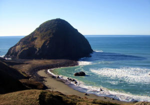
For the more adventurous, looking for views, a sea cave and remote beaches, don’t miss the Sisters Rocks. Sisters Rocks is a Oregon State Park but without any improvements. The parking lot is gravel with potholes and, after parking, there is a gate that could be marked “No Trespassing”. But for those willing to ignore the rusty sign, there is a short hike downhill to a moderate beach and the ocean. But don’t stop there. Continue up towards the large rock and a natural cave where the ocean roars in with the waves creating a visual and sonic treat. At extreme low tides, it is possible to hike into the ocean cave.
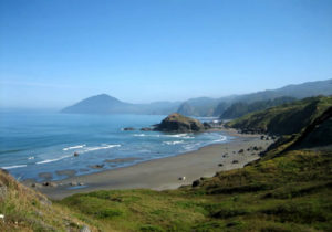
Sisters Rocks is also known as the Devil’s Backbone Rocky Shore Area and consists of 2.7 miles of offshore rocks and sandy beaches. The offshore rocks and islands are part of the Oregon Islands National Wildlife Refuge and contain colonies of seabirds. Sea lions are common in the area. Activities include tidepooling, beachcombing, bird watching, SCUBA diving, and sea kayaking.
Sisters Rocks is located north of Gold Beach and south of Port Orford, between mile markers 314 and 315 on US Route 101.
Download a GPX file for a hiking map from the parking lot to Sisters Rocks and the beach area. Download a kml file for use in Google Earth to see the hiking area.
Bailey Beach
Bailey Beach is a 5 mile stretch of beach from Otter Point to the Rogue River. This is a beautiful walk along the ocean and more...
Schrader Old Growth Trail
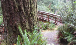
Frances Schrader Old Growth Trail 1172 (alternate spelling: Shrader) includes old growth Douglas fir and hardwoods trees all in a compact, easy to hike 1 to 1.5 mile (2.4 km) gravel trail. These majestic trees rival the California Redwoods in stature. A guide is available near the trailhead directing the hiker to numbered posts for areas of special interest along the trail.
The trail is suitable for all ages, is extremely well maintained and includes two benches and two picnic tables. There is a suitably large parking lot and a restroom.
While these trees are not the giant redwoods, they are nearly as impressive making a visit worthwhile.
To reach the trail, from US Route 101 at the Rogue River, travel east along Jerry’s Flat Road (County road 595) for 10 miles. Just before the Lobster Creek Bridge across the Rogue, is a right turn up Forest Service road 33 (Spur Road 060). There is a sign for the trail at this turn. The first portion of the road is paved, but it soon gives way to gravel but it is easily traveled by car. It is 2 miles (3 km) to the parking lot. The trailhead is immediately across the gravel road.
For more information, consult the Gold Beach Ranger District Office.
Gold Beach beaches
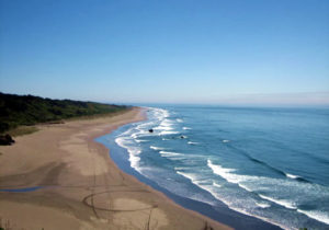
The beach immediately west of the town of Gold Beach is known as Agate Beach. It stretches from the south jetty of the Rogue River, down to Cape Sebastian. Towards the center is a landmark rock outcropping known as Kissing Rock which itself is located along Hunter Creek. Agate beach is 6 miles long. There are several creeks that travel through the beach, yet all can be crossed by foot during the dry season, with the possible exception of Hunter Creek. Towards the end of the summer, Hunter Creek can sometimes be crossed by foot.
To the north of the Rogue, and outside the city limits of Gold Beach is Bailey Beach. This beach is listed on some maps, incorrectly according to the locals, as Barley Beach.
Both beaches offer a chance for locals for a leisure stroll to enjoy the marine life. Look for seals as they poke their head above the water to see the shore activity. Surfing and wind surfing are common during the summer near the south jetty. All beaches are pet friendly. The town of Gold Beach does have a leash law, but that is not enforced in the state lands between the high and low mater marks.
Licensed vehicles are allowed on both beaches (but unlicensed motor vehicles are forbidden), yet few take advantage of the opportunity. During minus low tides, clamming (license required) is common on Bailey Beach.
333 Hiking Trail

The 333 trail has everything a day hiker could want on the Oregon Coast Trail: easy access, it is well marked, beautiful scenery, lots of options, and yet it is not widely used. The trail travels through an excellent example of a temperate rain forest, down to the Pacific Coast Trail. The hiker then has the option of heading north, to a beach destination, or south and a moderately challenging hike to the top of Cape Sebastian. Hiking time can vary from 2 to 5 hours depending on the route selected.
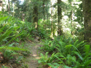
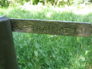
The trail is so named because it starts at the 333 mile marker on Route 101. There is an unimproved gravel parking area about 50 feet south of the entrance. Hike into the woods, following
the signpost for the Pacific Coast Trail into this first part of the trail. While there is a post indicating that the 333 trail goes to the right, take the left fork to continue to Cape Sebastian. If heading to the beach or Kissing rock, either the left branch or right branch will get you there, but the left fork is suggested. Continue downhill through the alder patches and marvel at this section of the trail that travels through the temperate rain forest.

Next, there is a signpost directing hikers to turn right to continue towards the Pacific Coast Trail. Make a mental note, as this turn may be easy to miss on your return trip. The trail continues down an access road and joins the Pacific Coast Trail at another marker. If taking the beach route, turn right and head north towards the beach (round trip is 2 hours). This hike is the shortest and easiest of the options. Otherwise, turn left and head south towards Cape Sebastian (round trip is 4 hours).
When heading south, the trail continues along an access road. Unfortunately, there are several roads in this area. As a general rule, bear to the right, even if the path looks less well traveled. The left turns head back uphill and towards Route 101.

Several Pacific Cost Trail markers line the route. Some of the trail can be overgrown, but is easy to follow. After hiking along the coast with several scenic overlooks, the trail heads up Cape Sebastian. This portion of the trail can be quite steep and challenging. The first hundred feet is the most difficult. After that, it is just steep. New steps are being installed in 2011 and this will be a considerable help. Follow to the top and the north parking lot of Cape Sebastian. If time allows, continue to the south parking lot and enjoy what may be the most spectacular view on the entire coast.
Not tired yet? Then continue south on Cape Sebastian, down to Pistol River and the beach to Meyers Creek. Otherwise, turn around and head back to the 333 trail parking lot.
Options:
Take two vehicles:
1) Park one at the Trail 333 parking lot and the second at the top of Cape Sebastian, or south along the coast at the first Pistol River parking lot.
2) Park one at the Trail 333 parking lot and the second one at the first parking lot south of Cape Sebastian (Meyers Creek).
3) Park one at the Trail 333 parking lot and the second further north at Kissing Rock.
Distances:
3.0 miles (4.8 km) from the trail head to the base of Cape Sebastian (one way).
3.6 miles (5.8 km) from the trail head to the north parking lot of Cape Sebastian (one way).
4.0 miles (6.5 km) from the trail head to the south parking lot of Cape Sebastian (one way).
6.5 miles (10.4 km) from the trail head to Meyers Creek parking lot (one way). 1300 ft total ascent.
Below is a map of the hike from the 333 mile marker up to Cape Sebastian (south) and back to the trail head. This hike can be done in either direction starting at Cape Sebastian, or at the 333 trail head.
Download a kml file of the hite from 333 TH to the Meyers Creek parking lot. Download GPX file of this hike.
Cape Sebastian
Cape Sebastian offers stunning views to the north and south on a clear day. This is a “must” for anyone traveling the Pacific Coast Highway Route 101 through Oregon. … more
Oregon Coast Trail – Arch Rock to Lone Ranch
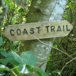
On the north, start just north of Arch Rock, … more
Rogue River Hiking Trail & Lower Rogue River Trail 1168 and the Rogue River Walk
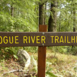
The Rogue River Trail follows the from east of Agness to near Galice, OR.
The Rogue River Trail is over 40 miles long and takes 4 to 5 days to cover. There are moderate grades, … more
Fritsche Cabin Trail

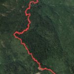
The Fritsche Cabin Trail is one of the more physically demanding trails in the Gold Beach / Rogue River area and is lightly used. The trail head starts at 200 ft (60 m) above sea level and climbs to 2400 ft (730 m) in 3.8 miles (6.1 km). It is generally well marked and ends in the general location of the cabin (apparently, there are not any remains of the cabin). The trail is perfect for those who are looking for a good workout and a quiet respite through the woods. The trail offers few views other than the surrounding woods and an occasional dramatic rock outcropping or soaring bald eagle.
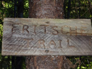
The trail head starts off on Forest Service Road 3300 – 160 which is in disrepair and not used. After a climb to about 700 ft, there is a striking rock outcropping. What remains of the road ends and the trail itself starts off to the right of the rock outcropping. Circle around the rock in a counter clockwise direction to follow the trail. The trail becomes much steeper and climbs up through the forest. Towards the end, the path is somewhat obscured by sporadic use of ATV’s. The trail followed in the GPX and KMZ files below veer slightly to the south of where the trail appears on the map and come out on an lightly used road to the old homestead.
The hike shown on most maps appears slightly to the north and there maybe an alternative route. The round trip is just under 8 miles (less than 13 km) and can take from 4 to 6 hours.
Getting there: The drive is easy. From Gold Beach, travel east down Jerry’s Flat Road, past the Lobster Creek Bridge where the road becomes NF-33. After passing the Quosatana Campground, the road curves around several sharp outcroppings, then crosses a small creek. The next creek is the larger of the two and is Bradford Creek. The trail head is just before the creek (west).
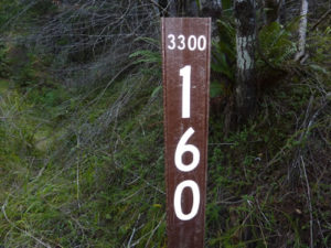
There is a small grass area that can be used for parking just east of the trail head on the river side of the road. The trail / road is identified by a small brown metal National Forest pole with the larger numbers “160” and smaller numbers “3300” at the top.
Download kmz file of this hike for use on Google Earth. Download GPX file of this hike for use in your GPS.
For more information, contact the Gold Beach Ranger District information center.
Illinois River Trail
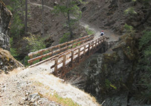
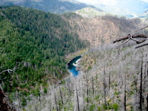
The Illinois River Trail (1161), located in the Siskiyou National Forest, is perfect for day hikers, backpacking, equestrians and class 3 ATV riding. It offers breathtaking views of the rugged Illinois canyon and the river below. Along the route is Buzzards Roost, which is a rock, outcropping offering unparalleled views of the valley. Wildflowers are abundant from late May through July. There are camping spots along the trail for those spending the night.
The trail offers an opportunity to see the dramatic effects of the 2002 Biscuit Fire (the largest in Oregon’s recorded history at the time) and the progress that nature has taken to recover from this catastrophic fire. Ironically, the destruction of some of the trees through fire has opened up views that would have otherwise been obstructed.
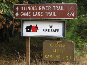 The trail is 27 miles (43 km) long starting near Agness (east of Gold Beach) and ending up west of Route 199 between Crescent City (CA) and Grants Pass. The trail starts out very easy with a gentle climb towards Buzzards Roost, and then continues descending slowly towards the Indigo Creek. The last portion towards the creek is somewhat steep with loose footings. The roundtrip to Buzzards Roost is about 2 & 1/2 hours. The roundtrip to Indigo Creek is 4 to 5 hours.
 Hiking to Buzzards Roost is straightforward (a few intersecting trails at the beginning – stay right towards the river). After Buzzards Roost, there is a trail to the left that leads up to Indigo Prairie. Continue going straight. A short distance later, the trail turns right and heads steeply down to Indigo Creek and a small bridge. Access to the creek from the bridge is nearly impossible.
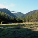
Instead of turning right and heading down to the Indigo Creek Bridge, backpackers can continue to an open field that is a favorite for overnight camping. This field is on the north side of Indigo Creek.
After Indigo Creek, the trail becomes more challenging climbing to over 3,700 feet at Bald Mountain. The trail does not follow the Illinois River through much of the Kalmiopsis Wilderness.
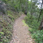 Getting there: The Illinois River Trail is located east of Gold Beach. Driving to the trail head is easy, offering access to one of the few interior hikes where the roads leading to the trail head are paved the entire way. From Gold Beach, turn east at the south end of the bridge to Jerry’s Flat Road (route 595 to NF-33). Follow for about 27 miles across the Illinois River bridge, turn right onto the narrow but paved Oak Flat Road (Rd-450) for about 3 more miles. Just before the pavement ends is parking for the trail head on the left. Total travel time is about 50 minutes.
Notes: Buzzards Roost, while offering fantastic views, is quite hazardous. Do not allow children or pets to climb out to this outcropping. A slip may result in a fatal fall. Other portions of the trail offer similar hazards, especially beyond Buzzards Roost (east). There is some poison oak along the trail – wear long pants. This trail, being in from the coast, is subject to hot weather in the summer and snow in the winter.

There is a primitive campground near the trail head. Swimming, kayaking and rafting are popular in the Illinois River near the trail head. There is a grocery store and a gas station approximately 4 miles away. Travel back towards the Rogue River and turn right.
According to the Oregon Parks and Recreation Department, class 3 (two wheel) ATV’s are allowed on the Illinois River Trail (Oregon ATV permit required) although not on the portions that go through the wilderness. There may also be seasonal restrictions – use of off-road vehicles during the summer months is not allowed.
Pine Grove Hike Trail 1170 – Rogue River – Siskiyou National Forest
The Pine Grove Hiking Trail starts at the Rogue River, 25 miles east of Gold Beach on the Oregon coast. The trail starts at an altitude of 600 feet (200 meters) and climbs to 2,700 feet (900 meters) over a distance of about 7 miles (11 km). Initially, the hike is extremely steep. Do not let this short portion discourage, because after the first 1/4 mile, the trail levels off to a mostly gradual climb. The trail is well marked yet is lightly traveled. There are views of the Rogue River as well as the surrounding Siskiyou mountains and the Illinois Valley.
Stating that the hiking trail has a distance of 7 miles is misleading, because of the 2100 ft climb.
Download kmz file of this hike for use on Google Earth. Download GPX file of this hike for use in your GPS.
McKinley Mine Trail
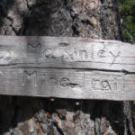
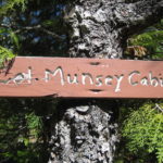
McKinley Mine Trail is an interesting hike into history, with the side benefit of views of the Siskiyou National Forest. The drive to the trail head is a relatively short 17 mile drive up asphalt and gravel roads. At the trail head is an unofficial campground. Start at the trail head near Signal Buttes and head west. The ruins of Col. Munsey cabin are about a 20 minute one-way hike and are marked by a sign. A short distance beyond is his grave, also marked by a sign and a pile of rocks. What remains of the mine is a short distance down hill, although others report a larger portion is just north of the trail (stay out of mines!). This trail continues down to the Lake of the Woods, which can be rounded, to return to the trail head.
Download kmz file of this hike for use on Google Earth. This file continues past the mine site and down to, then around The Lake of the Woods, but it is not necessary to hike that far to see the mine.
Download GPX file of this hike for use in your GPS.
Wild Horse Lookout
Wild Horse Lookout located a short distance up the Rogue River in the mountains, offers views of the Siskiyou National Forest as well as the Pacific. Note that some of the roads to the lookout are not paved but are accessible by automobile.
Wild Horse Lookout was built in 1935 and was last staffed in 1998. The cab collapsed under heavy snow during the winter of 2007/2008. The Sand Mountain Society has begun restoration, but presently, only the superstructure remains.
Presently only the superstructure is standing.
Directions: From Gold Beach, head north towards the Rogue River and turn right on Jerry’s Flat Road just prior to the bridge. Head east approximately 12 miles past Lobster Creek Bridge. Turn right at a sign for Wild Horse L. O. and travel the windy road to the lookout. Approximately an hour drive.
Snow Camp Trail
Snow Camp is better known for its lookout, but there is also a hiking trail of the same name. The Snow Camp north trail head is at FS route 3680 and travels just south of the lookout, across Windy Valley Creek and onto FS route 1407. The first part of the trail starts out at 3900 feet and travels through a spectacular old growth forest. It then moves out into an area burned by the 2002 Biscuit Fire, a destructive blaze that burned more than a half-million acres in Oregon and California. In this section, there are few trees and the trail can be obscured by low growing bushes. Above the trail is the lookout, located at the peak of the 4,223-foot Snow Camp Mountain. After passing below the lookout, the trail heads down into Windy Valley crossing the creek at 2800 feet and 3.5 miles from the beginning. There is not a bridge over the creek, so hikers have to be prepared to wade through water that flows most of the year. The hike continues up towards the south trail head, topping out at about 3200 feet onto FS route 1407. The entire route is about 5 miles one-way.
Just after passing below the lookout is a trail that rises up to the cabin. The cabin is reservable through the Forest Service. Please respect the privacy of those who have rented the cabin. There is another trail that heads to the south and it is a relatively short one to Panther Lake.
Driving to either trail head can be a challenge. The condition of these gravel roads can vary, so be certain to check with the Forest Service for conditions. Most of the time, the site can be reached using an standard automobile. However, these roads are subject to weather damage, and after a single storm they can become nearly impassible. Use of a 4-wheel vehicle or higher clearance vehicle is frequently recommended. The north trail head is more easily reached from Gold Beach, while the southern one is more easily reached from Brookings and the Chetco River. The car route between the two is closed in the fall although either route can be reached all year around. The roads are subject to heavy snow and are not maintained in the winter.
Download kmz file of this hike for use on Google Earth. Download GPX file of this hike for use in your GPS. These two files cover the hike from the northern trail head to the Windy Valley Creek and do not cover the southern trail head.
For more information, contact the Gold Beach Ranger District information center. The map below is for the north trail head.
Iron Mountain Botanical Area Trail
The Iron Mountain Botanical Area Trail is 2.7 miles long (4.3 km, each way), and is very dry – no water.
 Rhododendrons, azaleas, along with Port Orford cedar, white fir and pine trees are common along the trail. Views from the mountain and along the trail are excellent.
“At 4,000 feet elevation, Iron Mountain is one of the tallest mountains in the coast range. Geologically, it is composed of great intrusive masses of granitic rocks bordered by metamorphics such as serpentine, slate, and marble. Serpentine is rich in iron and magnesium, and can appear red or green depending upon the degree of reduction it has undergone. The presence of these minerals make plants work harder to grow in the soil. These soils are primarily responsible for the tremendous array of hardy plant life found in Iron Mountain. The Iron Mountain Botanical Area is home to an outstanding range of over 300 documented plant species!
Plants from the northern range (Oregon and Washington) overlap with plants from the southern range (California), giving the Iron Mountain area a unique combinations of plant species.
Download kmz file of this hike for use on Google Earth. Download GPX file of this hike for use in your GPS.
