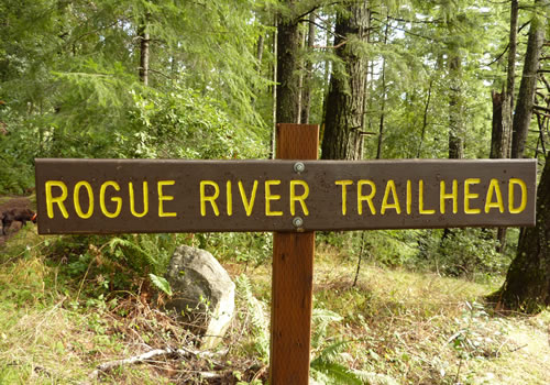
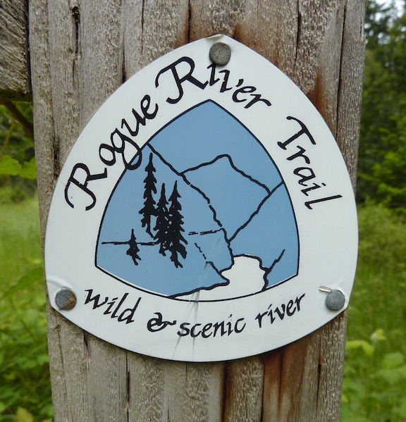
The Rogue River Trail
 There are two (or three or four) sections of the Rogue River Trail. This section refers to the part that is sometimes referred to as just the Rogue River Trail. The Upper Rogue River Trail starts at Crater Lake and travels 40.3 miles to Prospect, Oregon.
This section of the trail follows the wild and scenic Rogue River from Galice to just east of Agness. The trail continues east of Agness as The Lower Rogue River Trail (see the bottom of this page).
The Rogue River Trail is perfect for a day trip nature walk or a backpacking and camping trip. The trail may be hiked from either end or from the middle.
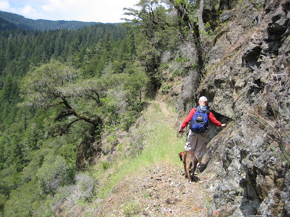
It is also possible to hike from lodge to lodge without ever pitching a tent. The trail offers unparallel experiences and views of the famous Rogue. The trail is well maintained by the BLM and the Forest Service and travels along the north bank of the river.
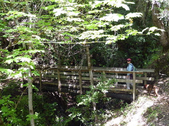
The Rogue River Trail is over 40 miles long and takes 4 to 5 days to cover. There are moderate grades, small bridges over creeks, campsites and private lodges along the trail (reservations required). Those wishing to travel the entire length usually start at the east end (Grave Creek near Galice) and head west as it is generally downhill. Many park at the west end, closest to Agness and Gold Beach and hike up river for an overnight (or longer) trip. Others can use the trail head as a starting point for a day hike or nature walk.
 The best time of the year to hike the trail is from May (after the rainy season) through October. The wettest month is December but rains can continue through early spring. In the summer, it can be quite hot and dry during the day, sometimes reaching 100 F (38 C), but quite chilly at night. There can be slides and downed trees during the winter and the BLM and Forest Service repair the trail in May.
To reach the east Agness trail head, follow Jerry’s Flat Road from Route 101 in Gold Beach for approximately 35 miles. Cross the Illinois River (do not turn right), then cross the Rogue River. Turn right (east) onto Agness – Illahe Road (County Road 375). Drive approximately 4 miles past the Illahe campground. The Rogue River Trail head is on the right. The mile markers refer to this western trail head.
 Latitude: 42.634682°, Longitude -124.050698°
There is also access to a middle point via Marial Road near Mule Creek, the Rogue River Ranch, Tucker Flat Campground and Marial Lodge (mile points 23 – 24).
For information about the Lower Rogue River Trail #1168 (from Agness to just east of Lobster Creek – towards Gold Beach), see the towards the bottom of this page.
Hints and Suggestions
While there is water available at several sites along the hike, it must be treated prior to drinking.
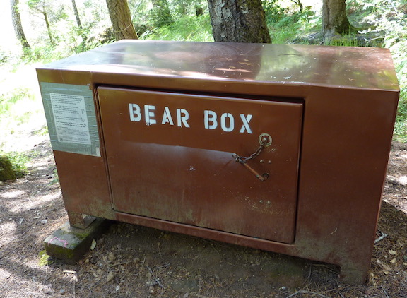
There are toilets at some campgrounds but not all. If camping overnight, it is wise to pack a plastic shovel to bury your waste. Look out for poison oak, ticks, rattlesnakes and black bears. While soap use is discouraged, it is wise to bring along and use a small amount to remove any poison oak from hands. Black bears can be a problem in the valley. Always use the widely available bear boxes or electric fences to store all food at night. If not available near your campsite, hang food at least 10 feet off the round and 4 feet from the trunk of a tree. See the Forest Service or BLM for bear proofing information. Cooking should be done on gas or propane stoves. Wood fires are discouraged as they scar this beautiful landscape (they are not allowed during fire season).
 It is possible to hike from lodge to lodge. However, each lodge must be contacted individually (see ‘Grave Creek to Watson Creek’ and ‘Watson Creek to Blue Jay Creek’) and many fill up with the river rafters, so plan well in advance.
The lodges are (distance is from the Grave Creek Trailhead – east trailhead):
- Morrison’s Rogue River Lodge – (10.4 miles upstream from Grave Creek Trailhead)
- Black Bar Lodge – 9.3 miles
- Marial Lodge – 23.9 miles – 541-474-2057
- Paradise Lodge – 27.4 miles / Half Moon Bar Lodge – 28.0 miles
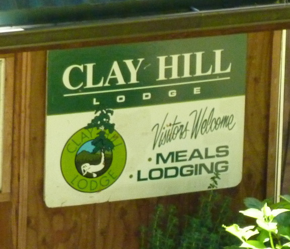
- Clay Hill Lodge – 33.2 miles
- Illiahe Lodge – 39.0 miles – 1.6 miles from the west trailhead.
The BLM provides an excellent brochure and mile by mile trail guide for the hike. There is also a website for most of the lodges.
More information is available from the BLM compact map plus a color map of the Rogue River Trail and campsites. There is also a map of the roads (from 2006, not necessarily up to date) in the area. Note that RV’s are not recommended on Route 23 and many of the other roads at any time of the year.
Rogue River Trail #1168
The Rogue River Trail #1168 (sometimes also referred to the Lower Rogue River Trail) is perfect for a day hike or a nature stroll. It is 12 miles long, offers excellent views of the river, and is easily accessed by car. It is common to see Osprey and an occasional eagle or bobcat. Black bears and mountain lions are not as common on this portion of the trail.
A hiker can start at one trail head for a round trip hike, or have two vehicles and hike the entire length. There are no camping facilitates, water or toilets on this portion of the trail.
There are two easy access points for day hikes:
1) The western end, located approximately 15 miles east of Gold Beach, or
2) Agness and west, located approximately 35 miles east of Gold Beach.
1) To reach the western end of the hiking trail, from the Patterson Bridge on Route 101, turn right up Jerry’s Flat Road (the south road along the Rogue). Drive east, approximately 10 miles to the Lobster Creek Bridge. Cross the bridge to the north side of the Rogue and take the first right down a gravel road 3533. Check your odometer as the trail head is 5.8 miles east. Continue for 3.4 miles and bear right and cross a small creek. Immediately, turn right and continue on 3533. When your odometer hits 4.8 miles, continue to the left. At 5.8 miles is a parking lot and the trail head. Note that parts of this gravel road may be difficult for cars with little clearance to drive. Latitude: 42.498587°, Longitude -124.207710°

2) To reach the west Agness trail head, follow Jerry’s Flat Road from Route 101 in Gold Beach for approximately 35 miles. Cross the Illinois River (do not turn right), then the Rogue River. Turn left and head back west down the Rogue River and into charming Agness along Agness – Illahe Road. Turn right at the charming Old Agness Store on Cougar Lane. Park at the Old Agness School and Library. Continue to hike down Cougar Lane which morphs into the Rogue River Trail. Latitude: 42.560048°, Longitude -124.073046°
From the western end, the trail is level and crosses several creek via small footbridges.
From the eastern end, after parking at the Old Agness School and Library, hike down the road past several private residences and follow signs for the trail that starts in 0.2 miles. The most spectacular portion of this trail is 2.7 miles ahead with a hike along the cliffs overlooking Copper Canyon.
Note that landslides and downed trees can block the trail after the winter. The Forest Service maintains the trail and generally has it restored by May.
Rogue River Walk
The lower Rogue River trail ends about 15 miles from the mouth of the Rogue River at Gold Beach. To many, the hike often seemed to be incomplete. As a result, volunteers completed an extension to the Rogue River & Lower Rogue River trails that ends just short of Gold Beach.
To access from the western end of the Lower Rogue River Trail, continue walking 5.8 miles along the gravel, lightly traveled, FS3533, west to the Lobster Creek Bridge and cross the Rogue River to the south bank. The Rogue River Walk continues from there for about 6 miles.
This trail is maintained by volunteers and its condition varies from year to year. Consult the Gold Beach Visitors Center for current status.