Interactive Map of the Southern Oregon Coast
There is a lot to see along the coast. Below is a map of where just about everything is located.
Looking at it this size can be quite confusing, so zoom into the area of interest. It maybe easier to click on the ‘larger map‘ link, then zoom in.
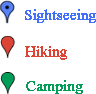 To try to simplify thing, we have broken it into three categories: Sightseeing, hiking and camping. These are color coded.
Categories are difficult. Sometimes, some sightseeing involves a little hiking. For example, visiting Indian Sands requires a 10 – 15 minute walk and is listed as ‘Hiking’.
The blue lines show how to get to the coast from nearby cities, I-5 and Crater Lake.