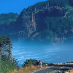
The Coast Trail, between Brookings and Gold Beach offers some of the finest scenery on the coast. The trail is well maintained, yet it is not crowded. Perfect for day hikes, there are ample parking areas along this section of the coast for easy access.
Hike as far as you want, then return to your car. Or better yet, take two cars and cover a larger area in the same amount of time.
Unfortunately, there is little of the trail south of Port Orford available for hiking, except for a small portion at Mt Humbug, so the travel is along US 101. There is a beach trail section around Ophir Beach.
The trail really re-starts at Otter Point, travels down to Bailey Beach for a 5 mile long hike to the Patterson Bridge across the Rogue.
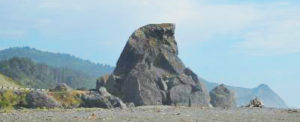
Next, turn right and cross into the port of Gold Beach and return to the sand and head south. Continue towards Turtle Rock south of town. Hunter’s Creek may block your walk except in late summer, so it maybe necessary to return to US 101. At Turtle Rock, continue along the beach towards the base of Cape Sebastian.

At Cape Sebastian, look for the trail to continue up to the top of the cape. This joins into the 333 Trail.
Follow the trail to the top of Cape Sebastian, where it briefly meets the southern parking lot. Stop and enjoy the views north, back towards Gold Beach, and south towards Pistol River. Continue down the cape onto the beach near Hunter’s Creek and Hunter’s Cove. Note that at certain high tides, exiting the trail at the base of Cape Sebastian maybe impossible.
Continue along the beach. One may have to return to US101 to cross Hunter’s Creek. Head south towards Pistol River. Pistol River is beautiful and is one of the most scenic areas in the world. Unfortunately, even during the dry season, Pistol River usually keeps flowing to the ocean, so it will once again be necessary to return to US 101 to continue south.
After Pistol River, the Oregon Coast Trail continues along US 101. There have been attempts to continue the trail through this area, but that is work in progress.
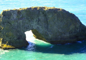
The trail resumes a few miles north of Arch Rock. From there, head south to the entrance of the trail (located near US 101 – look for the wooden post) into a fine example of a temperate rain forest. There is a short distance (0.4 mi) to the Spruce Island parking lot, then to the spectacular scenery of the coast along a cliff edge near Deer Point. The trail then heads back to the road, then down to Secret Beach (0.9 mi), then back across a wooden footbridge across Miner Creek (be certain to cross this bridge and not take the wider trail up to Route 101) and up towards the Thunder Cove parking lot. Take the loop out to view Thunder Cove as this section offers some of the most spectacular views that car bound visitors miss.
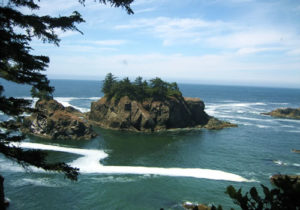
South from the Thunder Cove Parking lot, the trail continues towards the Natural Bridge parking area (0.2 mi) and then down to the Natural Bridge. Past the viewing area there is an unofficial trail down to the arch. This is not recommended as there are parts that are quite steep with extremely dangerous drop offs.
Past the Natural Bridges, the trail continues with parts along the highway. Note the views south where China Beach becomes visible (0.8 mi). Because of its name, Secret Beach gets the publicity. However, China Beach is actually more spectacular, larger and less visited. Note that it is nearly impossible to continue to travel south past a small out-cropping at mid or high tide so plan your trip near low tide and you will not be disappointed. Also, the access trails can be difficult to spot even though they are marked by the Oregon Coast Trail wooden markers (reports that the south post is missing and it is tough to find this trail – it is not all the way at the south end of the beach but near the mid-point of the south part of China Beach).
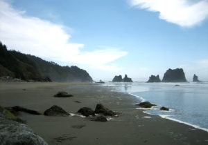
From the south side of China Beach, climb up towards Route 101 and the North Island Viewpoint (1.5 mi), then the Thomas Creek Bridge (0.9 mi). From Arch Rock to the Thomas Creek Bridge is about a four hour one-way hike.
The Oregon Coast Trail continues across the Thomas Creek Bridge, the highest bridge in the state of Oregon. This is the only significant section of the coast trail, from Arch Rock to House Rock, that travels on Route 101.
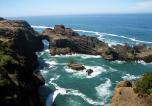
The section south of Thomas Creek Bridge to House Rock is another four hour one-way hike. From the Thomas Creek Bridge south parking lot, once again locate the Oregon Coast Trail wooden marker. Head south (the northern section offers a view of the bridge but is a dead end) and continue for views of hidden beaches and cliffs. The trail hugs the coast and is extremely well maintained while offering travel along the edge. Continue to Indian Sands (1.1 mi). Indian Sands is an archeological site that is listed on the National Register of Historic Places. Oregon State University has found evidence of human activity there dating back more than 10,000 years (digging is forbidden by law). To the casual hiker, the most spectacular part of Indian Sands are the arch and rock outcroppings on the south side of the sandy area, so please don’t rush through here and miss this sight.
From Indian Sands, hike south towards the Indian Sands parking lot (0.6 mi), then through the woods towards Whaleshead Beach (0.9 mi). Just prior to heading down towards Whaleshead, there is an unofficial trail that heads out to a point with views south towards the beach and north along the cliffs.
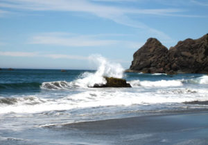
Whaleshead beach is a wonderful beach along the coast and is easily accessible to visitors as a road leads down to the beach. Restrooms and picnic tables are available. Follow the trail across the driveway and to the picnic area and then along the beach. The official trail shortly heads back uphill to the Whaleshead Beach viewpoint, then along Route 101. The more adventurous should continue along the beach south, towards its end. Again, it may be hard to find, but the trail picks up again with a very steep and challenging climb back up the hill towards Route 101. Keep and eye out for a different view of House Rock from the beach and during the climb.
After surviving the climb, the trail rejoins the Oregon Coast Trail and continues relatively uneventfully towards the House Rock parking lot and the view of House Rock.
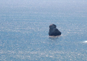
The hiking from Thomas Creek Bridge to House Rock is about 4 hours one-way.
The Coast Trail continues south towards Cape Ferrelo, then onto Lone Ranch where there are restroom and picnic facilities. South of Lone Ranch, the trail continues until the Rainbow Rock Condominiums where the scenic portion of the trail ends. From there, the Oregon Coast Trail continues along Route 101, through Brookings and down to the California state line.
Download a PDF map of the hike.
The award winning Walt Schroeder has written a mile by mile guide of the trail. Download the PDF here.
More information is available at the visitor centers along the coast and through the Oregon State Parks website. Download a map of the northern second and Download the southern section of the trail.
Short day hikes of this area are covered in the Brookings Hiking page.
