Sightseeing in the Gold Beach – Port Orford Area
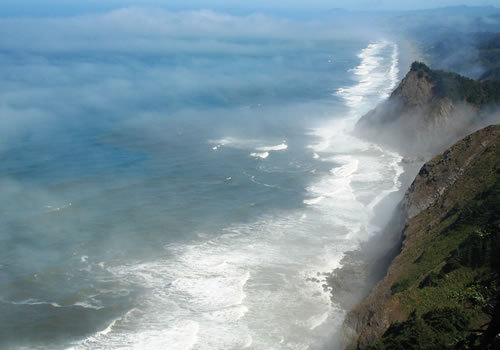
Prepare to be stunned. Miles and miles of US Route 101 hug the coast and offer coast and beach views from shear cliffs.

Gold Beach is at the mouth of the world famous Rogue River, and area roads will take you to the coast, or up the Rogue to the quaint village of Agness, the entrance to the Siskiyou National Forest and the Kalmiopsis Wilderness.
Port Orford is a working fishing port with views of the ocean and nearby Wild and Scenic Elk and Sixes Rivers. Be sure to visit the working port, plus the scenic viewpoints from the town on south. Visit the lighthouse and the coast guard station.
Jet Boats
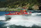
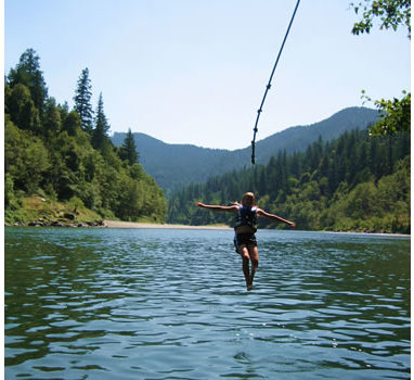
No vacation trip to the coast would be complete without an exciting river boat tour of the world famous Rogue River.
Sit back and enjoy the exciting ride as the jet boats safely navigate the strong currents and shallow riffles of this wild and scenic river. Enjoy the incredible scenery and watch the black bears, river otters, osprey, eagles and the occasional mountain lion.
Rogue River and Agness
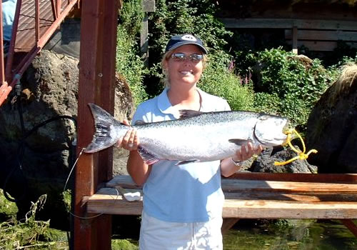
The best way to experience the Rogue River is to take a ride on one of the Jet Boats. Fishermen should make plans to stop and fish, either by renting a boat, or signing up with one of the highly skilled river guides.
For those looking for an alternative, take a short 22 mile scenic loop on the north and south banks of the Rogue. The round trip crosses … more
Cape Blanco Lighthouse and State Park
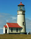
The Cape Blanco Lighthouse is a favorite location for whale watching and offers spectacular views.
The operating lighthouse has the highest focal plane above the sea, (256 feet), of any of the Oregon Lighthouses and is open for tours from April through October. From this vantage point and from the cliff, there is ample opportunity for bird and whale watching.
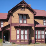
Built in 1898, the historic Hughes House is also located at the park with tours available while the lighthouse is open.
There is fishing access to Sixes River from the State Park.
The Cape Blanco State Park has over 8 miles of hiking trails, beach walks, and 7 miles of horse trails.
Cape Blanco State Park is located 4 miles north of Port Orford west of US Route 101. Turn west on Cape Blanco Road and drive 2 miles to the park entrance. All campsites are first-come, first-served. 53 electrical (maximum site 65 feet) for RV’s. To reserve cabins, horse campsites or the group camp, call 800-452-5687.
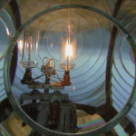
Visitor Hours: April 1 through October 31 – 10 am to 3:30 pm
Cape Blanco Lighthouse tours are closed on Monday.
Port Orford Heads State Park and Museum
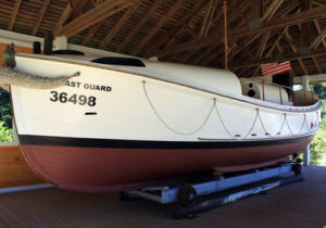
The Port Orford Lifeboat Station and Museum was constructed in 1934 and remained in service until 1970. It is listed on the National Register of Historic Places. The park has excellent hiking trails and beach access affording spectacular views up and down the Pacific Coast with opportunities for picnicking and marine wildlife and whale watching. There is a short (0.3 mile) trail from the museum out to the site of the former spotting tower. A slightly longer trail (0.4 mile) returns from the tower site to the museum and offers views of the former boathouse that is worthwhile if only because the challenges of launching a boat becomes readily apparent.
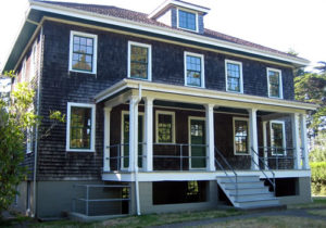
The Port Orford Lifeboat Station and Museum is free and is open April-October, Thursday-Monday, 10 a.m.-3:30 p.m. Admission is free. A 36-foot motor lifeboat used at this station is on display outside of the museum.
The biggest challenge is finding the turn to drive to this hidden gem. From US 101, turn west on 9th street, then left on Port Orford Highway / Coast Guard Hill. The turn off of US 101 can be spotted from the “Tsunami Evacuation Route” sign – one of the few that points towards the ocean. The museum parking lot is at the end of the short up-hill, winding road.
Rocky Point
Rocky Point is a scenic pull off with views of Humbug Mountain to the south. It is also a favorite place of locals to dig up butter clams at low tide. The area is popular with whale watchers, windsurfing and scuba diving.
Rocky Point is located 2 miles south of Port Orford, Oregon, along US Route 101.
The Isaac Lee Patterson Bridge
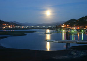
 The Isaac Lee Patterson Bridge was constructed in 1932 and is a prominent example of the designs of the Oregon bridge designer Conde McCullough. The bridge is a fine example of strong Art Deco influences and was designated a National Historic Civil Engineering Landmark by the American Society of Civil Engineers in 1982.
The Isaac Lee Patterson Bridge is located on the Rogue River in Gold Beach.
Otter Point
This little secret has great views of Cape Blanco to the north and Cape Sebastian to the south. It would be a mistake to pull into the parking lot, decide there is little to see and never get out of your car. more….
Bailey Beach
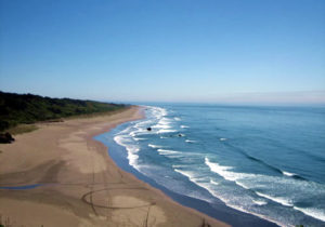
Bailey Beach is a lonely stretch of soft gentle sand that stretches more than 5miles and is a favorite for a relaxing stroll.
Dogs are (unofficially) welcome. 4-wheel drive access is allowed by licensed vehicles from the south. more….
Samuel H. Boardman State Scenic Corridor
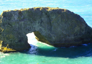
The stunning Samuel H. Boardman Scenic Corridor is a 12-mile stretch along the coast, of forested park with its spectacular coastline, rocky outcroppings, and smooth, sandy beaches. Marvel at Arch Rock, the Natural Bridges, and the shore birds or position yourself to watch the migrating whales. These breathtaking views are easily accessed from US Highway 101 for the casual traveler to what might be the most amazing scenery on the Pacific Coast. Hike portions of the 27-mile Oregon Coast Trail that starts just north of Brookings near House Rock and continue to Arch Rock. Harris Beach State Park with yurts, cabins, camping and full hookups is also just north of Brookings. Enjoy the California sea lions, Harbor seals, and go tide pooling at the rich marine gardens.
For detailed hikes within the Scenic Corridor, please see the Brookings Hiking Page.
The Samuel H. Boardman Scenic Corridor starts just north of Brookings Harbor and continues to about half way to Gold Beach. More detailed information on this amazing section of the coast is available on the Brookings portion of this website.
For more information, download a brochure of the park.
Agness
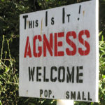
Agness is a tiny (population: 113 in 2007) community located near the confluence of two Wild and Scenic Rivers—the Lower Rogue River and the Illinois River. more……
Ophir Beach
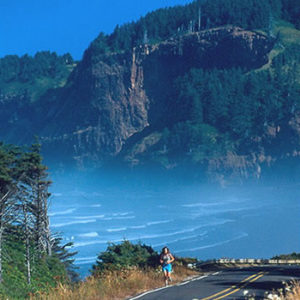
Ophir Beach is a 7-mile stretch of uncrowded beach with soft sand. The northern end is a good place to dig for clams at very low tides. Euchre creek cuts through to the ocean near the northern end of the beach, but during the summer and early fall, the creek disappears into the sand prior to reaching the ocean.
At the southern end is the unincorporated area known as Nesika Beach.
The Oregon Coast Trail travels along the beach, but follows US Route 101 north and south of the beach.
The Ophir rest stop is located along US Route 101 and offers ample parking as well as picnic tables and restrooms.
Ophir Beach is a few short miles north of Gold Beach. Ophir Beach is sometimes referred to as Nesika Beach.
The Mary D. Hume

The wreck of the Mary D. Hume is on sad display in the Port of Gold Beach, OR, in the harbor just off the Rogue River.
The Mary D. Hume was a steam boat built in Gold Beach in 1881 and survived as the oldest serving commercial vessel on the West Coast retiring in 1978.
During an attempt to restore her, there was a mechanical mishap and she slid off the sling to the bottom of the Gold Beach Harbor where she rests today. When driving on Route 101, please take a few moments and turn into the Port of Gold Beach south of the Rogue River and pay your respects to the Mary D. Hume.
Cape Sebastian

Cape Sebastian offers stunning views to the north and south on a clear day. This is a “must” stop for vacationers. From the south parking lot, there is a spectacular view of the Pistol River, 3 miles (5 km) to the south. Don’t stay in your car, but venture out a short distance on the trail on the west side of the parking lot for views … more
Pistol River
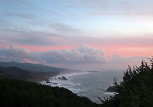
Pistol River is one of the most scenic stretches along any coast in the world. There are numerous scenic viewpoints that are worthwhile to pull over and take in the view. Meyers Beach and Hunters Cove, north of the mouth of Pistol River, are a favorite of surfers, wind surfers and equestrians, and is a wide, kid and pet friendly beach to walk along. At night, it is not unusual to see a bonfire built with driftwood. During low tides, the area is a favorite for digging razor clams. Boarded by Cape Sebastian to the north and Saddle Rock to the south, this area is one of the widest, longest and most scenic natural beaches in the Pacific Northwest.
Some of the activities on the Pistol River beaches include hiking, clamming, beach combing, windsurfing, surfing, hiking, and photography.
The International Windsurfing Tour holds the Pistol River Wavebash at Pistol River annually where many claim that “this stretch of the coast is the windiest spot of the state“.
North of Pistol River are numerous places to park and hike. Hunters Island is located towards the northern portion, just south of Cape Sebastian. Home to several species of marine birds, this is a favorite area for bird watching.
There is a gated road just south of Pistol River. A hiking trail wanders through the stabilized sand area and then into the dunes. The trail heads towards the ocean where it joins the horse trail marked with posts with a horseshoe painted on them. The left fork goes to the beach and onto Pistol River. The right fork travels through the dunes and wooded areas and back to highway 101 south of the river.
Pistol River is located 10 miles south of Gold Beach and 17 miles north of Brookings.
Gold Beach beaches
The beach immediately west of the town of Gold Beach is known as Agate Beach. It stretches from the south jetty of the Rogue River, down to Cape Sebastian. Towards the center is a landmark rock outcropping known as Kissing Rock which itself is located along Hunter Creek. Agate beach is 6 miles long. There are several creeks that travel through the beach, yet all can be crossed by foot during the dry season, with the possible exception of Hunter Creek. Towards the end of the summer, Hunter Creek can occasionally be crossed by foot.
To the north of the Rogue, and outside the city limits of Gold Beach is Bailey Beach. This beach is listed on some maps, incorrectly according to the locals, as Barley Beach.
Both beaches offer a chance for locals for a leisure stroll to enjoy the marine life. Look for seals as they poke their head above the water to see the shore activity. Surfing and wind surfing are common during the summer near the south jetty. All beaches are pet friendly. The town of Gold Beach does have a leash law, but that is not enforced in the state lands between the high and low mater marks.
Licensed vehicles are allowed on both beaches (but unlicensed motor vehicles and ATVs are forbidden), yet few take advantage of the opportunity. During minus low tides, clamming (license required) is common on Bailey Beach.
Kissing Rock
Kissing Rock, located just south of Gold Beach, OR, on US Route 101, next to Hunter Creek. There is ample parking immediately off of US101. Stop and enjoy and watch the sunset or take a fairly long hike south to Cape Sebastian.
Sisters Rocks
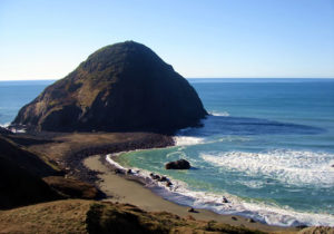
For the more adventurous, looking for views, a sea cave and remote beaches, don’t miss the Sisters Rocks. Sisters Rocks is a Oregon State Park but without any improvements. The parking lot is gravel with potholes and, after parking, there is a gate that could be marked “No Trespassing”, but ignore it. For those willing to ignore the rusty sign, there is a short hike downhill to a moderate beach and the ocean. But don’t stop there. Continue up towards the large rock and a natural cave where the ocean roars in with the waves creating a visual and sonic treat. At extreme low tides, it is possible to hike into the ocean cave, but watch out for rising tide and ‘sneaker waves’.
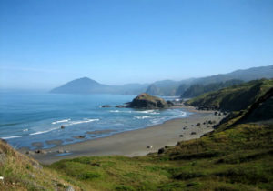
Sisters Rocks is also known as the Devil’s Backbone Rocky Shore Area and consists of 2.7 miles of offshore rocks and sandy beaches. The offshore rocks and islands are part of the Oregon Islands National Wildlife Refuge and contain colonies of seabirds. Sea lions are common in the area. Activities include tidepooling, beachcombing, bird watching, SCUBA diving, and sea kayaking.
Sisters Rocks is located north of Gold Beach and south of Port Orford, between mile markers 314 and 315 on US Route 101.
Download a GPX file for a hiking map from the parking lot to Sisters Rocks and the beach area. Download a kml file for use in Google Earth to see the hiking area.
Port of Port Orford
The port of Port Orford, OR, is an active home of commercial fishermen. No visit to the area is complete without a quick drive to the port. Turn towards the ocean on Washington or Oregon Street for a quick tour of the port of Port Orford.
After a tour of the port, don’t miss out on the other activities around Port Orford. There is Cape Blanco and the lighthouse (see below), just to the north. The Port Orford Heads State Park and Museum is in town, while Battle Rock is just south of the Port, on the southern edge of town. Then some of the most amazing views are right on Route 101, the Pacific Coast Highway, south of Port Orford through to Humbug State Park.
Schrader Old Growth Trail
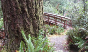
Frances Schrader Old Growth Trail 1172 (alternate spelling: Shrader) includes old growth Douglas fir and hardwoods trees all in a compact, easy to hike 1 to 1.5 mile (2.4 km) gravel trail. These majestic trees rival the California Redwoods in stature. A guide is available near the trailhead directing the hiker to numbered posts for areas of special interest along the trail.
The trail is suitable for all ages, is extremely well maintained and includes two benches and two picnic tables. There is a suitably large parking lot and a restroom.
To reach the trail, from US Route 101 at the Rogue River, travel east along Jerry’s Flat Road (County road 595) for 10 miles. Just before the Lobster Creek Bridge across the Rogue, is a right turn up Forest Service road 33 (Spur Road 060). There is a sign for the trail at this turn. The first portion of the road is paved, but it soon gives way to gravel but it is easily traveled by car. It is 2 miles (3 km) to the parking lot. The trailhead is immediately across the gravel road.
For more information, consult the Gold Beach Ranger District Office.
Map of Gold Beach
View Gold Beach – Port Orford Sighseeing in a larger map
Tradewinds Bamboo Nursery: Located in Gold Beach, Oregon Tradewinds Bamboo Nursery specializes in one of the world’s most important plants: bamboo. They grow more than 200 varieties of bamboo. Bamboo can range from a small six inch high ground cover to the tall majestic timber groves of fifty foot giants.


