Bike From Brookings to Crescent City
The fifth part of the trip.
It is 26 miles (42 km) from Brookings to Crescent City. Route 101 and this part of your cycling adventure is considerably less physically stressful than the previous section.

Starting out from Brookings or one of the parks north of town, travel through the urban center and cross the Chetco River. South of the Chetco is the unincorporated area of Harbor. After leaving Harbor, route 101 is nearly flat the entire way into Crescent City. There is no need to stay glued to Route 101, at it is recommended not to, as there is a smaller highway that parallels much of it. There are also few viewpoints from Route 101, which is why many stay on the side roads (see side trips below).
Chetco Valley Historical Museum is south of town on the east side of the road. Just prior to entering California, cross the Winchuck River. For the next few miles, the Pacific Coast Scenic Byway, stays near the coast, but there is a barrier of private property. Soon, the highway veers away from the coast through farmland. This is the lily capital where 90 percent the nations lilies are grown.
Next up is the small town of Smith River and then a bridge across the river and follow Route 101 into Crescent City.
Biking from Crescent City to Eureka – the next leg of the cycling trip.
Lodging
There is a large selection of hotels in Crescent City fitting all budgets. The nicest and more expensive motels are south of town.
Camping

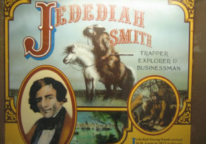
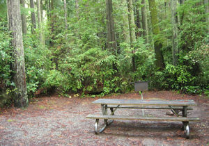
Crescent City has several camping areas, most centered around the Redwoods. Del Norte Coast Redwood State Park is located 7 miles south of Crescent City, Jedediah Smith Redwood State Park and Ruby Van Deventer Park are located just north and west, and Florence Keller Regional Park is located north of town. Clifford Kamph Memorial Park is located a short distance north of Crescent City and offers 9 tent camping spaces.
Side Trips
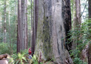
There are several side trips that make this trip worthwhile – the most important is a trip to the Redwoods.

After crossing the Chetco in Brookings, take your first right and swing down into Harbor on Lower Harbor Road. Harbor offers nice views of where the Chetco meets the Pacific Ocean, as well as several restaurants, shops and a public restroom. Lower Harbor Road becomes West Benham Lane. Just at the entrance to the Best Western is a right (west turn) into a nice gravel parking lot and RV park that is open to the public for ocean views.
As West Benham curves around and starts a climb, turn right on Oceanview Drive and follow back to Route 101 (if you wish to attend the Chetco Valley Historical Museum, turn east on Max / Woodruff Lane to Route 101).
Just before the boarder is the Oregon Visitors Center which offers a nice rest stop and restrooms.
After crossing into California, there is a left turn (east) onto Ocean View Drive. There is nothing especially scenic about this drive and it is a bit hilly, but it is a way to avoid cycling on Route 101.
On reaching the small town of Smith River, one can turn right (west) and cycle on South Fred D. Haight Drive (County Route D4) and avoid more Route 101.

Immediately after returning to Route 101 is the turn for Route 197, one of the routes to Jedediah Smith Redwood State Park. This is a wonderful park, yet the roads leading to it are somewhat narrow, with blind corners and little or no shoulders. Those who are especially safety conscious may want to (regretfully) skip this park and see the California redwoods further south of Crescent City. This turn also means the cyclers will miss the camping opportunities at Tolowa Dunes and Florence Keller Parks. For those willing to make the trip, the sights of the Redwoods and the Smith River are impressive. Note that camping spots in the Redwoods are scarce during the summer.

Returning from the Redwoods to Route 101 is even more treacherous. Route 199 back to Crescent City is the most direct route, but Route 199 is heavily traveled and there are even more blind curves that Route 197. A not great alternative is to take the packed gravel road through the park and out the south side of Crescent City, which is not impossible to do on a street bike.
If skipping this portion of the Redwoods, after crossing the Smith River, turn right (west) onto Lake Earl Drive (County Route D3) and follow it into Crescent City. Turn right on Washington Boulevard, and swing by the airport. Turn left (south) on Jordan Creek / North Pebble Beach Drive and tour the harbor area.
Biking from Crescent City to Eureka – the next leg of the cycling trip.
The map below indicates the bike route to take with several scenic side trails to Crescent City.
