The Redwoods
There is so much to see of the California Redwoods that we have dedicated an entire section all to itself. More information…..
Battery Point Lighthouse
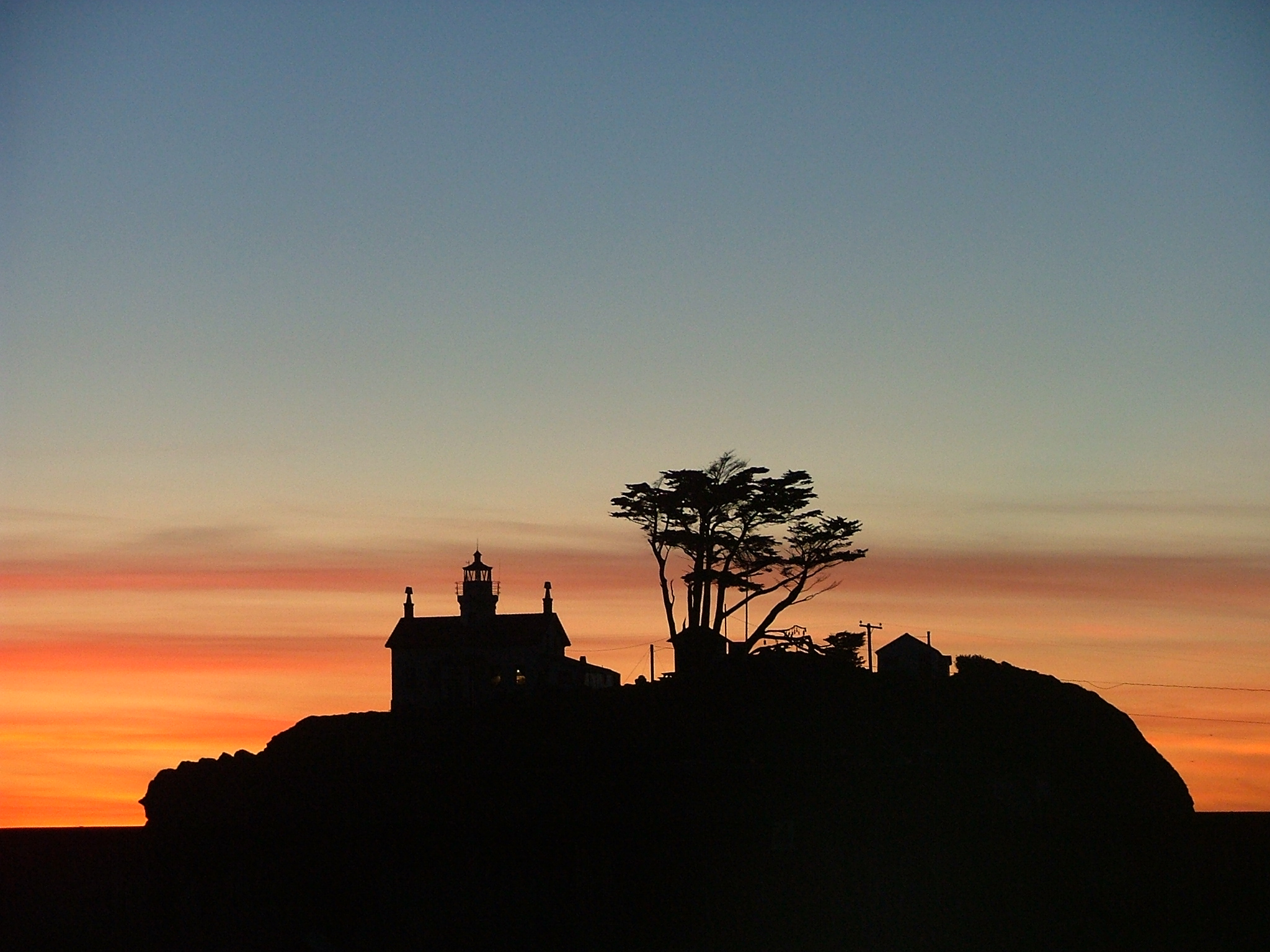
The Battery Point Lighthouse was constructed in 1856 and consists of a 45 foot tower and a dwelling house where the resident curators live today. It is accessible by foot below high tide. It is a working lighthouse and the residents provide tours to the public from April 1 through September 30. 707-464-3089
The Battery Point Lighthouse is located in Crescent City, a short distance west of downtown and US Route 101. Turn west at Front Street and follow to the lighthouse.
St. Georges Reef Lighthouse

Located 6 miles (10 km) west of Crescent City, the St. George Lighthouse is the “lost” lighthouse of the Pacific Coast. Built in 1892, the lighthouse is the most dangerous and most expensive of the lighthouses constructed in the United States. Several people died during its construction and many more died during operation. It was also one of the loneliest assignments (no families permitted) and most unpleasant tours of duty in the service. As a result, dozens requested transfer and a few are reported to have gone mad while stationed there.
The lighthouse is located on a barren rock off the coast. Constructed on an elliptical concrete pier 70 feet high, access to the lighthouse could be precarious. Arriving boats were attached to a 60-foot long boom and lifted off the ocean to load and off load supplies and personnel. While the waves were rising and falling up to 15 feet, the mariners had 20 to 45 seconds to quickly snag the boom hook with a huge O-ring. If they missed, they were at risk of being smashed against the rocks.
Storms routinely crested over the top deck of the base which contain the living quarters. In a particularly spectacular 1952 storm, 160 foot waves broke the windows in the lantern room 150 feet (46 m) above sea level sending seawater streaming down the tower’s staircase.
The lighthouse continued in operation until 1975. It’s 6000-pound first order Fresnel lens was removed and is on display at the Del Norte County Historical Museum in Crescent City. Access to the lighthouse is available only via helicopter flights being offered by the St. George Reef Lighthouse
Preservation Society.
On clear days, the lighthouse is visible from the shoreline from Crescent City to north of Brookings. A favorite spot is at the 9th Street viewpoint in Crescent City. Although a little far south to be ideal, on a clear day, the lighthouse is clearly visible.
Tolowa Dunes and Lake Earl
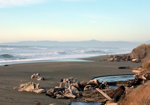 The 5,000 acre Tolowa Dunes State Park and the 6,134 acre Lake Earl Wildlife Area are some of the finest wetlands habitats in the state. The park and wildlife area include wood ridges, wetlands, ancient sand dunes, and ocean beaches. The park serves as an important stopover for the Pacific flyway, the west coast bird migrations route, and features a diverse bird population. Lake Earl is mostly freshwater while Lake Tolowa has a higher salt content. Surrounding the lakes are saltwater marshland, freshwater wetlands, and sand dunes.
Hundreds of species of birds can be photographed, including the rare Canada Aleutian goose, canvasbacks and the Peregrine falcon. Sea lions and harbor seals and gray whales can be spotted along the coast.
Lake Earl has been included in an effort to restore grebe habitat along the coastal flyway. Lake Earl is the only coastal nesting area for grebe between British Columbia and Santa Barbara. Educational kiosks have been installed to inform the public of the grebe habitat that consists of floating island-nests on the lake. The grebe live on island nests in order to swim down and get fish, plus they have limited mobility on land. Boaters, kayaks and canoes are required to stay away from the grebes’ floating nests.
The Tolowa Dunes State Park is located north and south of the Lake Earl Wildlife Area.
There are two primitive campgrounds and includes a ride-in horse camp within the State Park. Off road, or ATV use is not allowed.
There are 20 miles of hiking trail that wind through the park. However, many of the paths are sandy, which make them slow-going. Guided nature walks are offered in the summer. While most of the Pacific Coast is mosquito free, this is not true of this park. Please be prepared and take repellent.
A directional map of the Lake Earl Wildlife Area is available.
Directions: From Crescent City, California, turn onto Northcrest Drive north from The Pacific Coast Highway US 101. From Northcrest Drive, access roads are Old Mill Road and further along Northcrest Drive (which becomes Lake Earl Dr.) turn left on Lower Lake Road to Kellogg or Pala Roads.
(707) 464-6101
Download a kml file for use in Google Earth to see the hiking area.