Castle Rock Wildlife Refuge

Castle Rock Wildlife Refuge is the second largest sea bird colony in California and the third largest in the lower 48 states.
May through July is the best time to view breeding of the seabirds. There are spectacular fly-offs at dawn.
There are more than 80,000 seabirds nesting and breeding on the island of at least eleven species.
To reach the refuge, follow signs to the airport from route 101 near Crescent City. Turn left on Pebble Beach Drive. Parking and interpretive signs are almost immediately on your right.
Tolowa Dunes and Lake Earl
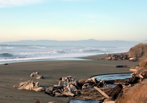
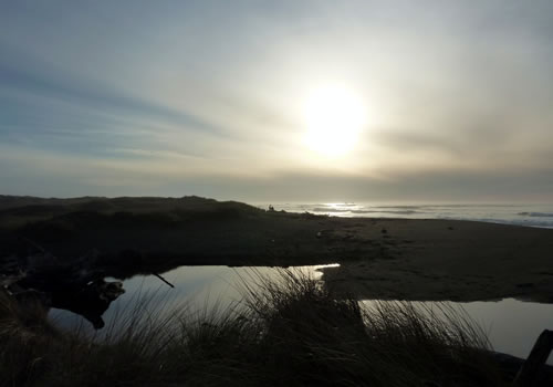 The 5,000 acre Tolowa Dunes State Park and the 6,134 acre Lake Earl Wildlife Area are some of the finest wetlands habitats in California. The park and wildlife area include wood ridges, wetlands, ancient sand dunes, and ocean beaches. The park serves as an important stopover for the Pacific flyway, the west coast bird migrations route, and features a diverse bird population. Lake Earl is mostly freshwater while Lake Tolowa has a higher salt content. Surrounding the lakes are saltwater marshland, freshwater wetlands, and sand dunes.
Hundreds of species of birds can be photographed, including
the rare Canada Aleutian goose, canvasbacks and the Peregrine falcon. Sea lions and harbor seals and gray whales can be spotted along the coast.
 Lake Earl has been included in an effort to restore grebe habitat along the coastal flyway. Lake Earl is the only coastal nesting area for grebe between British Columbia and Santa Barbara. Educational kiosks have been installed to inform the public of the grebe habitat that consists of floating island-nests on the lake. The grebe live on island nests in order to swim down and get fish, plus they have limited mobility on land. Boaters, kayaks and canoes are required to stay away from the grebes’ floating nests.
The Tolowa Dunes State Park is located north and south of the Lake Earl Wildlife Area.
There are two primitive campgrounds and includes a ride-in horse camp within the State Park. Off road, or ATV use is not allowed.
There are 20 miles of hiking trail that wind through the park. However, many of the paths are sandy, which make them slow-going. Guided nature walks are offered in the summer. While most of the Pacific Coast is mosquito free, this is not true of this park. Please be prepared and take repellent.
A directional map of the Lake Earl Wildlife Area is available.
Directions: From Crescent City, California, turn onto Northcrest Drive north from The Pacific Coast Highway US 101. From Northcrest Drive, access roads are Old Mill Road and further along Northcrest Drive (which becomes Lake Earl Dr.) turn left on Lower Lake Road to Kellogg or Pala Roads.
(707) 464-6101
Below is a map of a hike in the dune area.