For avid hikers, the Bandon area does not have the attraction of nearby wilderness or national forests. However, it does have the Oregon Coast Trail, which travels through town and along the beach with spectacular scenery. However, this portion of trail offers challenges in that significant rivers need to be crossed south of town, and this can only be accomplished at low tide during the dry season (late summer into early fall). There is camping north of town, and the next camping area is not until reaching Floras Lake (March 15 – September 15).

East of Bandon is the Powers Ranger District and access to the Siskiyou National Forest and portions of the Rogue River Wilderness. There are several primitive campgrounds along the Coquille River and many challenging hikes. Drive time is generally two hours each way. Be certain to check with the Powers Ranger District (541-439-6200) about any road closures.
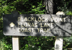
Blacklock Point – Floras Lake Hike

Blacklock Point is one of the most beautiful spots on the coast, but few are willing to make the hike to see it. The view to the south is of Cape Blanco and the beam from the lighthouse is clearly visible. To the north is a view of the spectacular yellow cliffs (access to the beach below the cliffs is from the north end near Floras Lake and should only be hiked at low tide). The hike to Floras Lake offers access to the beach and the southern edge of Floras Lake.

The Blacklock Point – Floras Lake hike is unlike many of those on the Oregon coast in that it is nearly flat and can be used by mountain bikes and equestrians. The hike starts at a small parking area near a local airport and heads to scenic viewpoints along cliffs, then north to the beaches along Floras Lake.
A loop to both Blacklock Point and Floras Lake is a 10 mile (16 km) round trip. The hike to Blacklock Point is about a 4 mile (6.5 km) round trip.
Download a GPX of this hike for use in your GPS. Right-click to download a KMZ file for use in Google Earth.
Hanging Rock

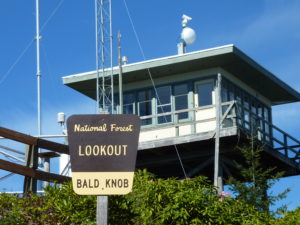
Hanging Rock, Panther Ridge, Bald Knob and Bald Knob Lookout are located in the same general area of of the Siskiyou National Forest, most of it within the Wild Rogue Wilderness.
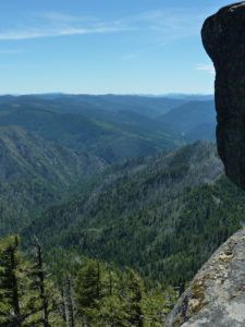
Hanging Rock is at 3954 ft (1205 m) and offers perhaps the most spectacular view in the Siskiyou.
Hanging Rock is at the far eastern (northern) end of Panther Ridge, spectacularly jutting out over Eden Valley and the Rogue River canyon. On a clear day, it is possible to see the snow caps of the Oregon Cascades, including 9000 ft (2700 m) Mt. McLaughlin which is 85 miles (140 km) away.
Download a GPX of this hike for use in your GPS. Download a KMZ file for use in Google Earth.
Barklow Mountain Trail

This trail follows the ridge line and offers a nice view of the surrounding mountains. On a clear day, it is possible to see the ocean. There is a long abandoned partially collapsed Forest Service shelter just off the trail, that is interesting to visit. Barklow Mountain is 3579 ft. The trail travels through the Copper Salmon Wilderness. From mid-May through late June, the area is covered with beautiful wild flowers and rhododendron.
Download a GPX of this hike for use in your GPS. Download a KMZ file for use in Google Earth.
Download a GPX of the west portion of this hike for use in your GPS. Download a KMZ file of the west portion for use in Google Earth.
Oregon Coast Trail – Bandon to Port Orford

Bandon offers hiking along the beach. For those traveling along the Oregon Coast Trail, this area offers a few special challenges. Most of the hiking is along the beach and four rivers must be crossed. Most of these rivers are impassible at high tide, or during the rainy season. High water in these rivers can stretch into early summer depending on how wet the spring has been.
Starting out a Bullards Beach State Park, which is just north of Bandon, head out to US Route 101 and cross the Coquille River on the drawbridge. This bridge is especially hazardous, as it does not have a sidewalk. After crossing the bridge, bear right and hike along the Bandon Marsh Bird Sanctuary, to 1st street through Old Town Bandon, and back along to the beach along the south jetty of the Coquille River.
After reaching the beach, it is mostly beach walking until just north of Port Orford. The next rivers are Four Mile Creek and New River and these can only be crossed at low tide. Additionally, there is no camping along the beach from March 15th to September 15.
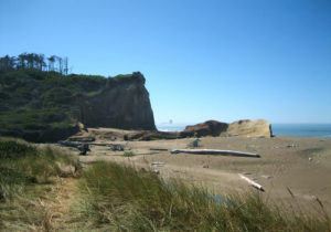
South of New River is Floras Lake Park and camping is available. Continuing south, finding the next part of the trial is tricky. At the end of the lake, the trail leaves the beach. Missing this turn can leave the hiker trapped further south along the beach as it disappears into the cliffs. Look for a trail that is lined with logs (see photo above). There is a marker further up into the woods. It is possible to cut up into this trail further down the beach.
After entering the trail, take the first right and hike parallel to the beach. There are a few unofficial campsites in the woods.
After a couple of miles, the hiker is greeted by a view at Blacklock Point of the Cape Blanco Lighthouse to the south. Follow a trail south to the beach and cross the Sixes River at low tide. This may be the easiest of the rivers to cross.
Hike up to Cape Blanco. There is a nice State Park campground at Cape Blanco. From the cape, head down to the beach and cross the Elk River. South of Cape Blanco, enter Tseriadun State Recreation Site. The Site is on the south shore of Garrison Lake just north of Port Orford Heads – the cape further south. Hike into Port Orford via 12th street to Arizona Street to 9th onto US Route 101.
The award winning Walt Schroeder has written a mile by mile guide of the southern portion of this trail (Floras Lake) and points south. Download the PDF map here and a description here.
More information is available at the visitor centers along the coast and through the Oregon State Parks website.
